The GTA Place - Grand Theft Auto news, forums, information, screenshots, guides, cheats...
Incredible FAKE Map
Yep, I finally have got around to posting the second version of tnk's awesome fake map. This one has taken ideas from all of the community, and put them all into one super-map that is the most accurate with what we know so far. tnk has watermarked this version from the start, and there is also a very handy copy detection system that is just about impossible to get through. Anyway, this is the most accurate fake map on the info we know, so enjoy, and be sure to give tnk credit.
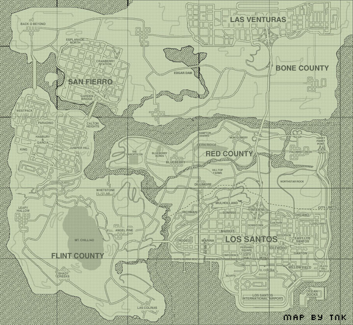
Submitted by tnk
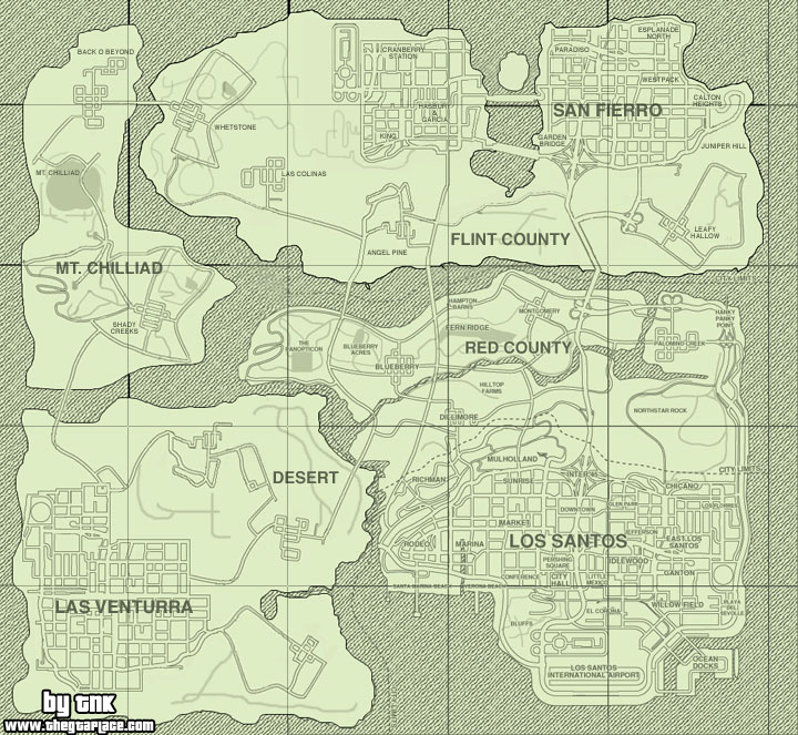
and just incase you didn't see tnk's first version of this map, here it is, you can see it has a few mistakes which is what caused all the commotion about it


Time to get back into the spotlight tnk ;-)
I'm back to debate the map... :-)
My internet was down for a few days since I was moving apartments.... rite now im on a dialup on a friend's comp 
So here's the list of "known facts"... pls update them if new info has come out in the last few days since I haven't been monitoring for new info...
01) Big Buildings seen from HP Point... not check.
02) Lots of country between LS and SF... check.
03) Possiblity of mountain(s) between LS and SF... check.
04) Bone county (desert) visible from Panopticon... check.
05) Flint county (mountain) visible from Panopticon... check.
06) SF airport visible from Panopticon... not check.
07) Atleast one SF bridge connects to non-urban area which may or may not be mountainous... check.
08) "America-shaped map" (I remember reading this somewhere)... not check.
09) Lots of open countryside for small towns... check.
10) Bridge from Rodeo going west... check.
11) "City Limit" north of Red County a possibility... not check.
12) "City Limit" west of Rodeo a possibility... not check unless it refers to LS's city limits.
13) Map about 4-6 times > VC assuming LS = VC... check.
14) SF might straddle a river/sea/inlet/creek/bay etc... check.
15) Angel Pine near the base of Mt. Chilliad... check.
Browse more Website pages
This fansite is officially recognised by Rockstar Games, but is owned and run independently.
About | Advertising | Privacy Policy & Cookies | Manage Cookie Settings
Comments